

Similar Projects


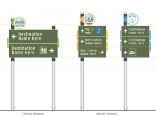
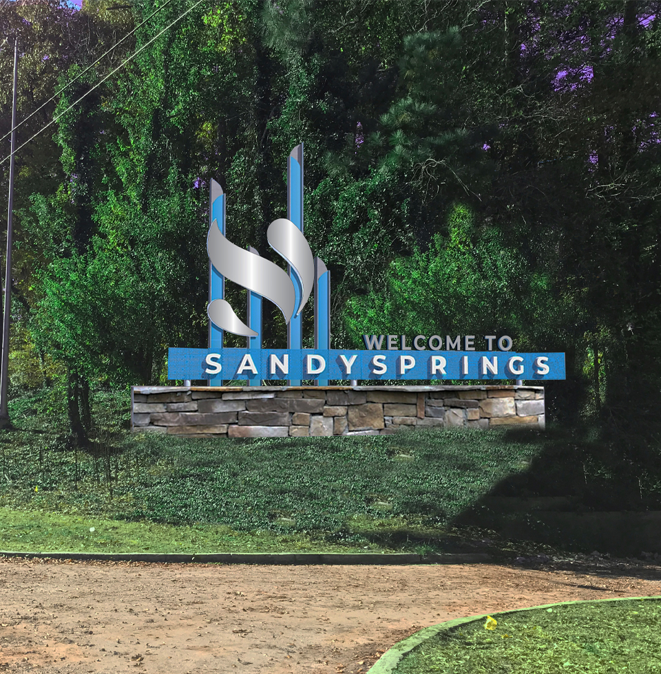
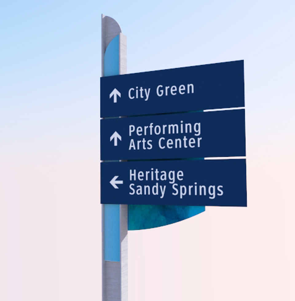
Sandy Springs
Wayfinding Program
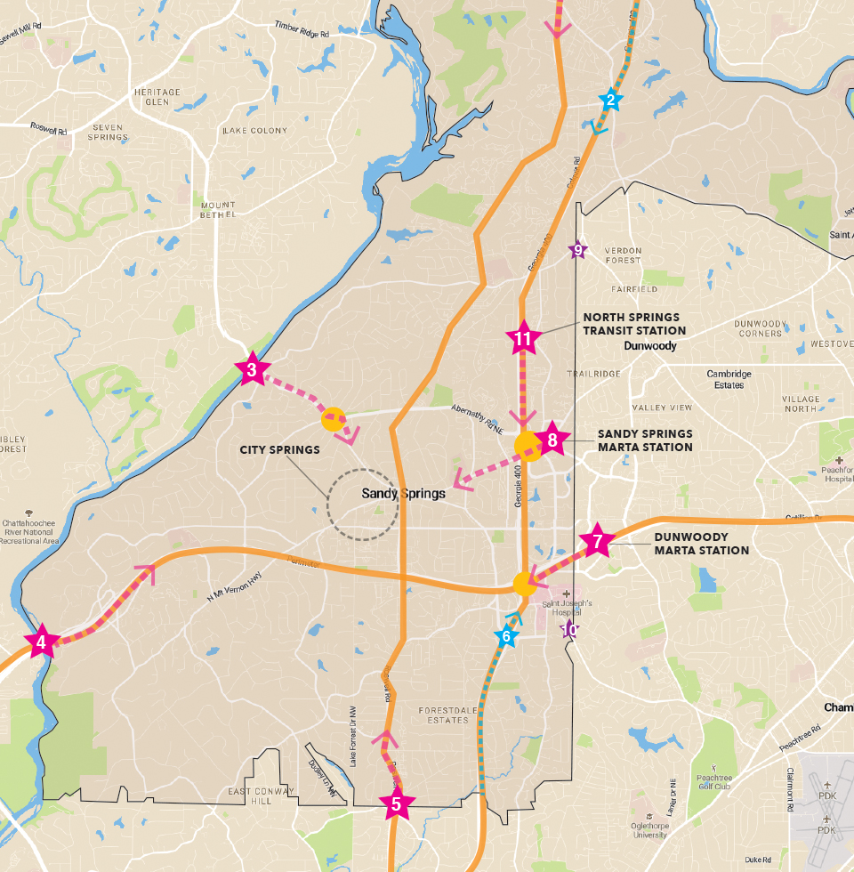
The City of Sandy Springs is metropolitan Atlanta’s second (2nd) largest city. With a geographic area of 38 square miles, the city includes, several hundred acres of parkland, 22 miles of shoreline along the Chattahoochee River, including three units of the National Park Service. There are also three MARTA rail stations that serve the community, providing park-n-ride service to Atlanta and access to the Sandy Springs Medical District and Perimeter Business District.
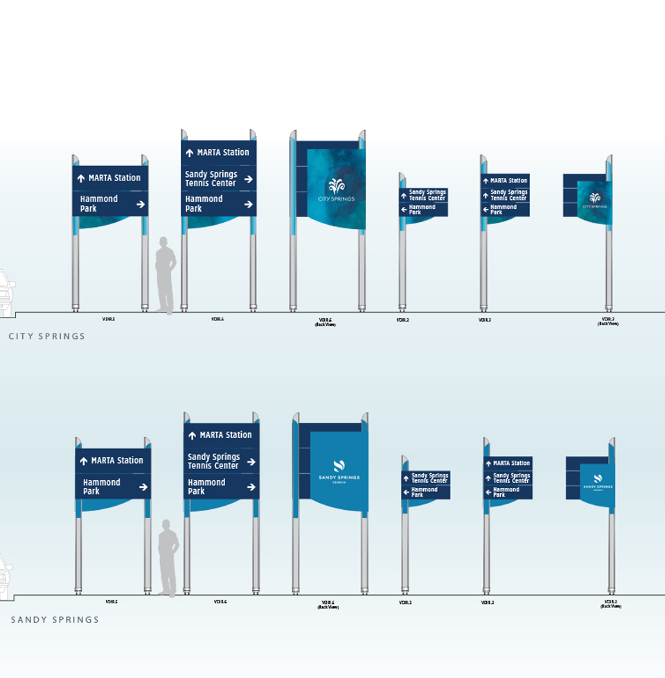
The City has hired MERJE to plan and design a comprehensive wayfinding program. Primarily a vehicular oriented system and with expected circulation changes in the next 5 years due to new highway access points, the system is modular and easily updatable. The design is heavily branded with the Sandy Spring identity, but also changes in aesthetics as a visitor transitions from the modern suburban areas of town to the rural wooded neighborhoods and parks. Pedestrian signs and kiosk will be included in City Spring District and the Perimeter Business District, helping to promote events, make connections to public transit and orient users to the city and region in general. MERJE is also coordinating with GDOT and the National Park Service to gain project approvals.