transit

IndyGo

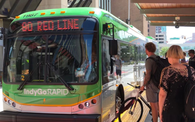
IndyGo’s Red Line is a bold, new era of efficient, rider-focused Bus Rapid Transit for the City of Indianapolis. The first of its rapid transit lines it sets the standard for how the system will be planned, designed and built. For 13 miles, IndyGo’s new Redline is a milestone in improved capacity, comfort and comprehensive accommodation for every rider’s experience. The Redline runs 7 days a week, with frequency of 10-20 minutes. Its easy to ride and accessible to work, education, healthcare, restaurants, entertainment, and shopping.

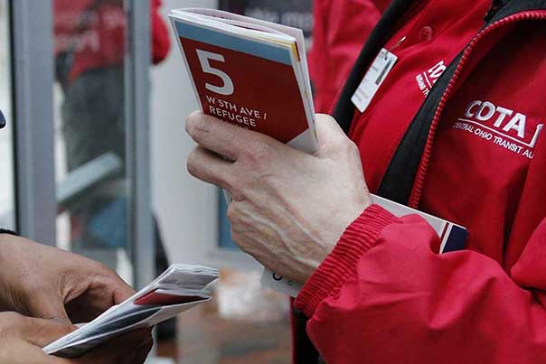
Indygo contracted MERJE to develop the mapping series for the redline and overall IndyGo bus system. With 28 rapid transit stations, each stop received an individual map of the local area and connecting routes. A specific map was developed for the downtown that included additional detail about attractions, landmarks and amenities.

St. Louis METRO

Cities, towns and communities understand in order to provide a higher quality of life and compete economically with other cities, an accessible, efficient and reliable transit system is a priority. The St. Louis METRO Wayfinding Audit looks to benchmark some of the most common practices from other sucessful multi-modal cities to see where Metro may improve their performance and make better connections to its users.

MERJE, with Daniel Boyle Associates has conducted a Wayfinding Audit that looks at all forms of communication and customer touch-points. Signage, information hierarchy, maps and terminology are all primary issues that are considered. The plan offers a series of recommendations and a phasing plan for implementation.

Miami Trolley

Miami’s “Trolley” service – buses designed with a retro look – is one of the most popular features of the City’s dynamic downtown. MERJE worked with the City of Miami and the Miami Downtown Development Authority to design the identity, trolley graphics, maps and trolley stop signage.

The graphics create a flexible and recognizable identity system across a variety elements. The circle pattern reinforces the active and vibrant urban experience and maps are positioned at each trolley stop to orient visitors and direct them to the different destinations they may visit. Consistently expanding, the Miami Trolley now carries more than 2500 passengers a week, helping to reduce traffic, ease demands on parking and offering a multi-modal option for visitors and residents alike.

Fayetteville Airport Sign Back Detail

Fayetteville Airport

Located in the “City of Dogwoods,” the Fayetteville Regional Airport serves a 12-county area in the Sandhills of southern North Carolina, along the I-95 corridor. Fayetteville Regional Airport is serviced by three main airlines: US Airways Express, with daily service to its Charlotte, NC hub; ASA, the Delta Connection, with daily service to its Atlanta hub; and American Eagle Airlines, with daily service to Dallas/Ft. Worth.

The design of the program is a natural extension of the City of Fayetteville Wayfinding Program, also designed by MERJE. Details were added to reflect the airport identity and the sizes and configuration were adjusted to assist the airport specific wayfinding needs. Stone bases are incorporated to match the context of the environment and building architecture. The project installed in late 2012.

DART

Dallas Area Rapid Transit (DART) services to 13 cities in the Dallas/Fort Worth Metroplex. Transportation services include bus, an electric light-rail system, a commuter rail line, ride-share programs, curb-side services for the mobility impaired, and transit educational services. MERJE conducted a Customer Communication Audit and subsequent improvement recommendations for communicating to DART customers in print, electronic, stationary fixed signage, and on-board methods and modes. An overall review of the effectiveness of the current DART customer informational landscape enables the agency to define areas needing improvement, with the goal of enhancing and simplifying customer information, and how it is delivered.

COTA

The Central Ohio Transit Authority (COTA) serves 562 square miles, 69 Bus lines, over 3,000 bus stops, 350 passenger shelters, 28 Park and Rides and 62,000 daily riders (more than 19 million annually).

In May 2017, COTA transitioned over to a completely re-designed bus route system. The new system embraces the philosophy of higher frequency and provides more direct crosstown access. MERJE and Daniel Boyle & Associates to assisted in the analysis and design of a new signage and wayfinding program. The design team developed the strategies that include how all information is organized around a consistent approach to communication and how it can connect all wayfinding, marketing and operational tools to each other.